


 24/7 Emergency Service
Day One of Hurricane Preparedness Week: Risk Assessment
5/1/2022 (Permalink)
 Determining your risk is the first part of Hurricane Preparedness Month!
To kick off Hurricane Preparedness Week, the first part of preparation is determining your risk. Everyone lives in an area with some flood risk, it’s just a question of whether you live in a high-risk, low-risk, or moderate-risk flood area.
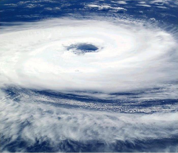
Do You Know Where to Track a Hurricane?
Learn about your flood zone and know your risk. The NOAA can help you with its Historical Hurricane Tracks Tool that uses your zip code to display paths of past storms related to your location.
Can You Predict Your Chance of Flooding Due to a Hurricane?
Using flood maps can show you your community’s risk of flooding. Specifically, flood maps show a community’s flood zone, floodplain boundaries, and base flood elevation.
What Are Flood Maps?
Flood maps show a community’s risk of flooding. Specifically, flood maps show a community’s flood zone, floodplain boundaries, and base flood elevation.
Where Can You Find Your Flood Map?
You can find your flood map on the FEMA Flood Map Service Center.
Can Your Flood Risk Change?
How water flows and drains can change due to new construction and community development or natural forces such as changing weather patterns or terrain changes. Also, communities may build levees and dams, decreasing flood risk over time. Although the frequency or severity of impacts cannot be changed, FEMA is working with federal, state, tribal and local partners across the nation to identify flood risk and promote informed planning and development practices to help reduce that risk through the Risk Mapping, Assessment and Planning (Risk MAP) program. To better reflect your current flood risk, the National Flood Insurance Program and the Federal Emergency Management Agency use the latest technology and data to update flood maps nationwide.